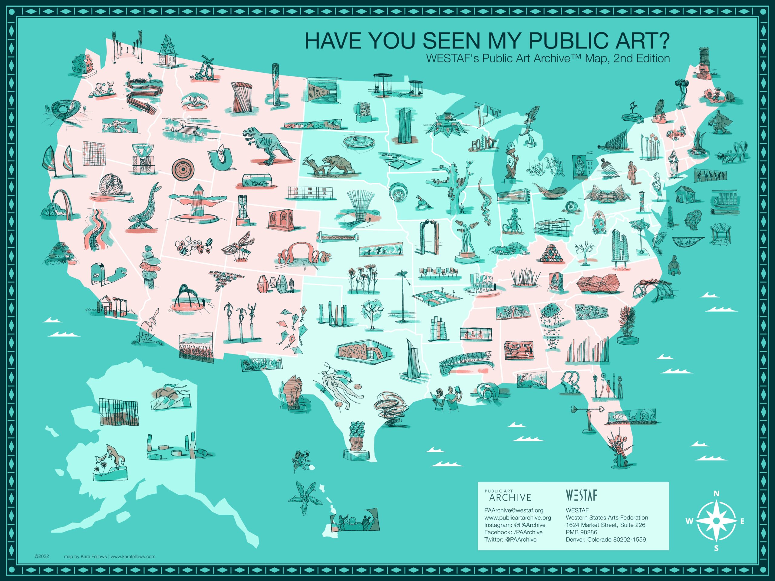
*This map is an illustration. Artworks are not drawn to scale and their placements on the map may not be exact. For accurate information regarding artwork locations, we welcome you to engage with the interactive map to view the individual artwork detail pages.
Join the Public Art Archive™ (PAA) as we celebrate the 10th anniversary of our Have You Seen My Public Art? map with a brand new version! The original map was created in 2013 and quickly became the program’s most recognizable visual. Since that time, the PAA team has continued its mission to make public art more public, archiving almost 20,000 public artworks around the U.S. and abroad in the process. This new map, illustrated by artist Kara Fellows, highlights a diverse array of public artists and their artworks from across the country.
The second edition of the map includes 144 artworks across all 50 states created by over 176 unique artists and studios, most within the last 10 years. Projects vary in type (i.e., outdoor sculpture, mural paintings, wall pieces, etc.), placement (universities, parks, municipal buildings, transportation spaces, etc.), media (steel, paint, wood, etc.), theme, and budget. The collection highlights a mixture of both permanently sited and temporarily installed works.
Over 500 submissions were received, and while not all of the projects are included in the map, they have all been cataloged in the PAA database and are available for public exploration on both the desktop site and the Locate Public Art app used for discovering artworks on-the-go. We hope that this map reignites the desire and need for a central repository of public art data so that every community has the opportunity to engage with public art.
Love public art as much as we do? Share the news with your networks by using this social media toolkit!